Skip to main content
Profile Button
Site search input
Sign In
Try for free
Site search input
Subjects
Art
Health and Safety
Home Learning
Language Arts and Writing
Languages
Mathematics
Music
Physical Education
Library
Reading and Literature
Geography
Science
Government
Social Studies and History
21st Century Skills-SEL
Grades
Early Learning
Pre-K
Kindergarten
1st Grade
2nd Grade
3rd Grade
4th Grade
5th Grade
6th Grade
7th Grade
8th Grade
9th Grade
10th Grade
11th Grade
12th Grade
Planning
Awards & Certificates
Back-to-School Headquarters
Blog Articles
Bulletin Boards
Classroom Activities
Classroom Forms
Classroom Passes & Notes
Games
Graphic Organizers
Graphs & Charts
Lesson Plans
Literature Guides
Mini-Lessons
Project-based Learning
Rubrics
Themed Packets
Videos & Activities
Worksheets
Educator's Calendar
Warm-Ups: Math
Warm-Ups: Reading
Strategies
Assessment
Behavior Management
Classroom Management
Classroom Organization
Educational Technology
English-Language Learners
Getting to Know Your Students
Icebreakers
New Teacher Resources
Open House Resources
Professional Development
Remote Learning
Report Card Comments & Phrases
Self-Care Resources
Social-Emotional Learning
Special Needs
Study Skills and Test Prep
Teacher-Parent Collaboration
Teaching Tips and Advice
Themes
Animals
Autumn
Back to School
Biographies
Community Helpers and Jobs
Dinosaurs
Famous Explorers
Family
Green Activities
Heroes
Human and Animal Homes
Health & Nutrition
Insects and Bugs
Inventors and Inventions
Oceans
Plants
Space
Spring
Summer
All Kinds of Weather
Winter
Women in STEM
Holidays
Asian American and Pacific Islander Heritage Month
Black History Month
Chinese New Year
Christmas
Columbus Day
Day of the Dead
Earth Day
Easter
Father's Day
Flag Day
Fourth of July
Groundhog Day
Halloween
Hanukkah
Hispanic Heritage Month
Kwanzaa
Labor Day
Martin Luther King Day
Memorial Day
Mother's Day
Native American Heritage Month
New Year's Day
Passover
Presidents' Day
St. Patrick's Day
Teacher Appreciation Week
Thanksgiving
Valentine's Day
Veterans Day
Women's History Month
PBL
Self-Care
Store
For Schools
Individual Plans
School Plans
Sign in
Oceans (Oceanography)
Filter
Sort by:
Most-Popular
Relevance
Most Popular
Most Recent
Most Popular
x
Oceans (Oceanography)
(66) results found
WORKSHEETS
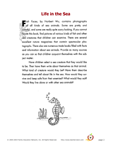
Life in the Sea
Use writing prompts to get children's imaginations and writing skills flowing. This is a sample page from the Gr. 1-4…
Subjects:
Language Arts and Writing
Creative Writing
Science
Download
Add to Favorites
Add to Folder
creative writing
children's book
activities
classroom tools
language arts and writing
vocabulary
Create new folder
CREATE NEW FOLDER
CLASSROOM TOOLS
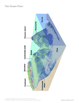
The Ocean Floor
Identify ocean landforms, including guyots and trenches, with this labeled diagram of the sea floor.
Subjects:
Science
Earth Science
Oceans (Oceanography)
Download
Add to Favorites
Add to Folder
creative writing
children's book
activities
classroom tools
language arts and writing
vocabulary
Create new folder
CREATE NEW FOLDER
WORKSHEETS
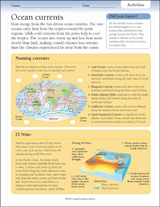
Ocean Currents Worksheet
Learn about ocean currents around the world. In this weather worksheet, students read about El Niño and use the…
Subjects:
Science
Earth Science
Oceans (Oceanography)
Download
Add to Favorites
Add to Folder
creative writing
children's book
activities
classroom tools
language arts and writing
vocabulary
Create new folder
CREATE NEW FOLDER
GAMES AND APPS
Animal Habitat Crossword Puzzle
A crossword puzzle on animal habitats.
Subjects:
Rainforests
Animals (Zoology)
Insects
Download
Add to Favorites
Add to Folder
creative writing
children's book
activities
classroom tools
language arts and writing
vocabulary
Create new folder
CREATE NEW FOLDER
LESSON PLANS
Wave Bottle
Students will create wave bottles and observe the motion and patterns of waves. This lesson is a great supplement to…
Subjects
Science
Earth Science
Oceans (Oceanography)
Download
Add to Favorites
Add to Folder
creative writing
children's book
activities
classroom tools
language arts and writing
vocabulary
Create new folder
CREATE NEW FOLDER
LESSON PLANS
How Big Is a Blue Whale?
Students will practice their predicting and measuring skills by comparing the size of a blue whale to various objects.
Subjects
Science
Animals (Zoology)
Aquatic Animals
Download
Add to Favorites
Add to Folder
creative writing
children's book
activities
classroom tools
language arts and writing
vocabulary
Create new folder
CREATE NEW FOLDER
DAILY WARM-UPS
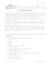
Ocean Food Chain Reading Warm-Up
Introduce the ocean food chain with this life science printable. For this reading warm-up, students will read a short…
Subjects:
Language Arts and Writing
Social Studies and History
Science
Download
Add to Favorites
Add to Folder
creative writing
children's book
activities
classroom tools
language arts and writing
vocabulary
Create new folder
CREATE NEW FOLDER
MAPS
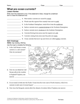
What Are Ocean Currents?
Give students practice reading a map with the skill challenge in this oceanography printable. Students will evaluate…
Subjects:
Science
Earth Science
Oceans (Oceanography)
Download
Add to Favorites
Add to Folder
creative writing
children's book
activities
classroom tools
language arts and writing
vocabulary
Create new folder
CREATE NEW FOLDER
WORKSHEETS
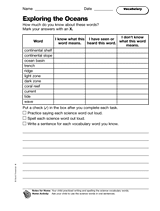
Exploring the Oceans: Vocabulary
Distribute a printable set of vocabulary words related to the oceans.
Subjects:
Oceans (Oceanography)
Earth Science
Science
Download
Add to Favorites
Add to Folder
creative writing
children's book
activities
classroom tools
language arts and writing
vocabulary
Create new folder
CREATE NEW FOLDER
WORKSHEETS
The Mysterious Bermuda Triangle
Interesting facts and fun activities related to an area of the Caribbean Ocean known as the Bermuda Triangle.
Subjects:
Reading and Literature
Legends
Oceans (Oceanography)
Download
Add to Favorites
Add to Folder
creative writing
children's book
activities
classroom tools
language arts and writing
vocabulary
Create new folder
CREATE NEW FOLDER
DAILY WARM-UPS
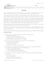
Science Reading Warm-Up: Oceans
Develop students' nonfiction reading skills as they learn about the ocean. This printable warm-up includes a science…
Subjects:
Oceans (Oceanography)
Earth Science
Science
Download
Add to Favorites
Add to Folder
creative writing
children's book
activities
classroom tools
language arts and writing
vocabulary
Create new folder
CREATE NEW FOLDER
WORKSHEETS
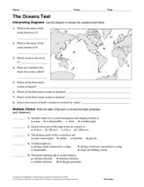
Test: The Oceans
Multiple-choice and written-response questions in this Earth science exam will test students' knowledge and…
Subjects:
Science
Earth Science
Oceans (Oceanography)
Download
Add to Favorites
Add to Folder
creative writing
children's book
activities
classroom tools
language arts and writing
vocabulary
Create new folder
CREATE NEW FOLDER
CLASSROOM TOOLS
Under the Sea Theme
Use an ocean theme in your science lessons with this printable ideas and bulletin board example.
Subjects:
Oceans (Oceanography)
Earth Science
Science
Download
Add to Favorites
Add to Folder
creative writing
children's book
activities
classroom tools
language arts and writing
vocabulary
Create new folder
CREATE NEW FOLDER
LESSON PLANS
Camouflage
Students observe the effects of camouflage.
Subjects
Arctic and Polar Regions
Rainforests
Animals (Zoology)
Download
Add to Favorites
Add to Folder
creative writing
children's book
activities
classroom tools
language arts and writing
vocabulary
Create new folder
CREATE NEW FOLDER
LESSON PLANS
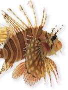
Instant Expert: Oceans
Become an instant expert on oceans. Find motivational mini-lessons and the reference material you need to reinforce key…
Subjects:
Science
Biology
Fish
Download
Add to Favorites
Add to Folder
creative writing
children's book
activities
classroom tools
language arts and writing
vocabulary
Create new folder
CREATE NEW FOLDER
WORKSHEETS
Ocean Depths
Interesting facts and fun activities related to the ocean.
Subjects:
Oceans (Oceanography)
Earth Science
Science
Download
Add to Favorites
Add to Folder
creative writing
children's book
activities
classroom tools
language arts and writing
vocabulary
Create new folder
CREATE NEW FOLDER
WORKSHEETS
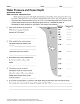
Activity: Water Pressure and Ocean Depth
Examine the relationship of water pressure and ocean depth with the reading passage and graph in this printable.…
Subjects:
Science
Earth Science
Oceans (Oceanography)
Download
Add to Favorites
Add to Folder
creative writing
children's book
activities
classroom tools
language arts and writing
vocabulary
Create new folder
CREATE NEW FOLDER
WORKSHEETS
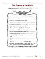
The Oceans of the World
Develop library-skills with this activity that focuses on information skills.
Subjects:
Library Resources
Language Arts and Writing
Geography
Download
Add to Favorites
Add to Folder
creative writing
children's book
activities
classroom tools
language arts and writing
vocabulary
Create new folder
CREATE NEW FOLDER
LESSON PLANS
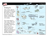
Ocean Zones Mini-Lesson — PowerPoint Slideshow
Give students a general introduction to the main zones in the ocean with these PowerPoint slides. Students will learn…
Subjects:
Oceans (Oceanography)
Fish
Aquatic Animals
Download
Add to Favorites
Add to Folder
creative writing
children's book
activities
classroom tools
language arts and writing
vocabulary
Create new folder
CREATE NEW FOLDER
WORKSHEETS
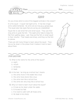
Nonfiction Reading Warm-Up: Squid
Students learn about squid and develop their nonfiction reading skills in this reading warm-up. This printable includes…
Subjects:
Aquatic Animals
Oceans (Oceanography)
Animals (Zoology)
Download
Add to Favorites
Add to Folder
creative writing
children's book
activities
classroom tools
language arts and writing
vocabulary
Create new folder
CREATE NEW FOLDER
LESSON PLANS
Sea Horses: Father Knows Best
Students learn about the unusual world of the sea horse -- in which the father fish carries and gives birth to the…
Subjects
Animals (Zoology)
Oceans (Oceanography)
Biology
Download
Add to Favorites
Add to Folder
creative writing
children's book
activities
classroom tools
language arts and writing
vocabulary
Create new folder
CREATE NEW FOLDER
ACTIVITIES
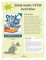
STEM Activities for Stink and the Shark Sleepover
Learn about sea creatures through STEM activities for Stink and the Shark Sleepover. Each activity helps students work…
Subjects:
Comics, Graphic Novels, & Illustrated Novels
Animals (Zoology)
Aquatic Animals
Download
Add to Favorites
Add to Folder
creative writing
children's book
activities
classroom tools
language arts and writing
vocabulary
Create new folder
CREATE NEW FOLDER
TEACHING RESOURCE
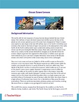
Ocean Zones Background Information
This resource is designed to be used in conjunction with the Ocean Zones Mini-Lesson. Use this resource as an…
Subjects:
Oceans (Oceanography)
Science
Earth Science
Download
Add to Favorites
Add to Folder
creative writing
children's book
activities
classroom tools
language arts and writing
vocabulary
Create new folder
CREATE NEW FOLDER
DAILY WARM-UPS
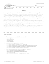
Science Reading Warm-Up: Ocean Waves
Students learn about what causes ocean waves through this science reading passage. Check their understanding of the…
Subjects:
Reading Comprehension
Oceans (Oceanography)
Language Arts and Writing
Download
Add to Favorites
Add to Folder
creative writing
children's book
activities
classroom tools
language arts and writing
vocabulary
Create new folder
CREATE NEW FOLDER
Pagination
Current page
1
Page
2
Page
3
Next page
›
Last page
»
Register